Ordnance Survey 25-inch Series England and Wales 1841-1952
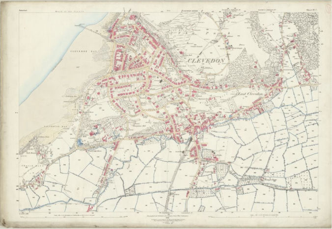
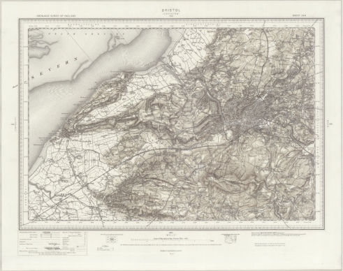
Somerset IV 7
Survey: 1883, published 1885
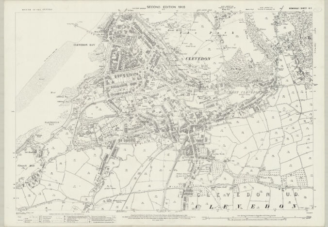
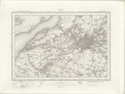
Somerset IV 7
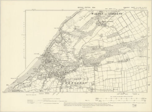
Revision: 1902, published 1903
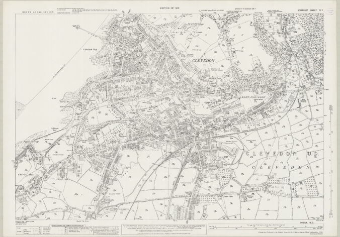
Somerset IV 7
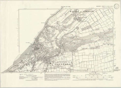
Revision: 1930, published 1932
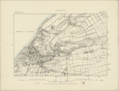
Survey: 1883, published 1885
Revision: 1902, published 1903
Revision: 1930, published 1932
Survey: 1882-83, published 1885
Revision: 1902, published 1904
Revision: 1930, published 1932
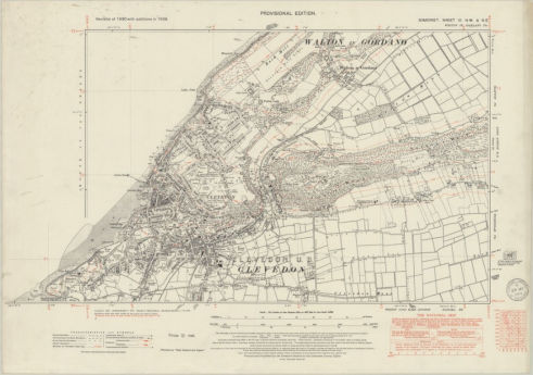
Revision: 1938, published c1949
Revision: 1897,
published 1898
Revision: 1897,
published 1898
Revision: 1930 and later corrections, published 1946
Revision: 1930 and later corrections, published 1946
Revision: 1949, published: 1953
Revision 1949 with updates to 1964, published: 1967
Revision 1949 with updates to 1956, published 1958
Revison 1949 with updates to 1964, published 1965
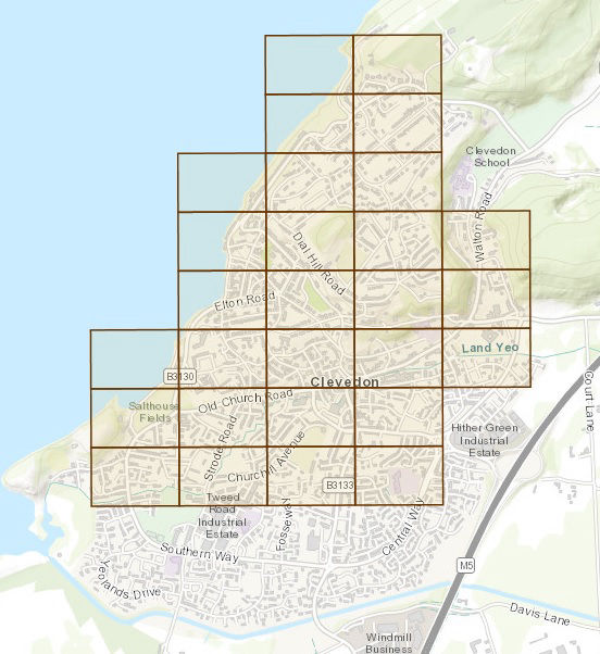
OS 1:500 Town Maps, 1883
Clevedon is one of the Towns that has had its 1:500 Town Map digitised and is available on the NLS Map Archive. These highly detailed maps cover about 1600ft by 1000ft each, and there are 28 sheets covering Clevedon as it was then.
Click here or on the image to the left to go to an overview map. Select a box and then the image that appears in the top right to see the individual map sheet.
Somerset IV 3 & 7 - Survey: 1883, published 1885
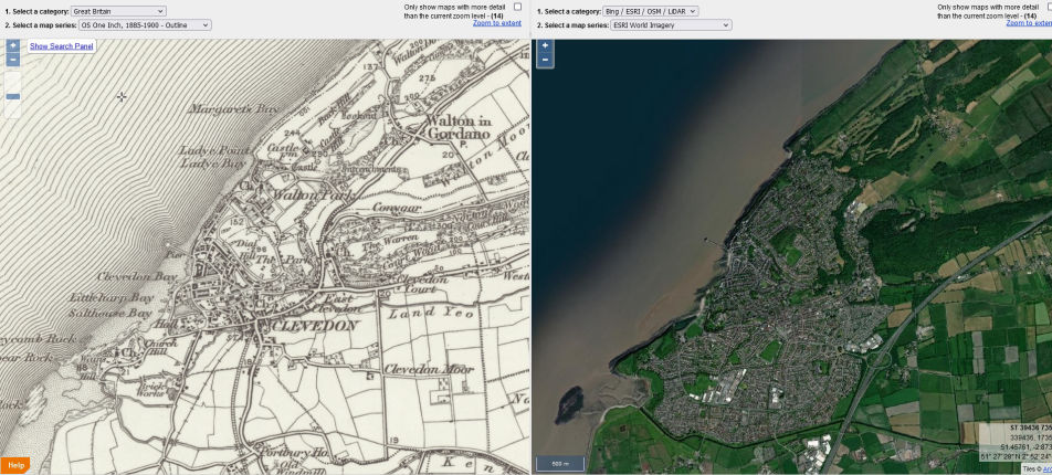
The NLS Map Archive also has a 'Side-by-Side' viewer which enables you to compare old maps with a current-day view of the same area.
To view this for Clevedon, click here or on the map image to the right. You chose the map series in the drop down box above the map, and the current-day view in the drop-down box above the view. Zoom and scroll either half and the other half follows.

No Code Website Builder